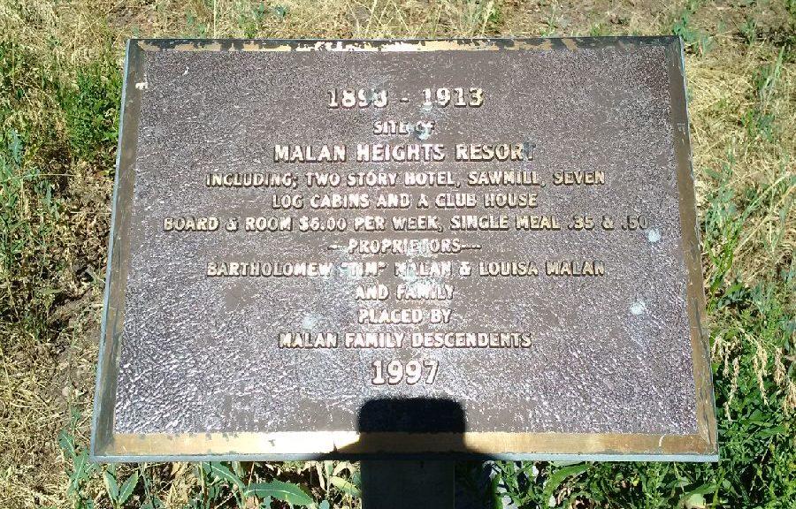
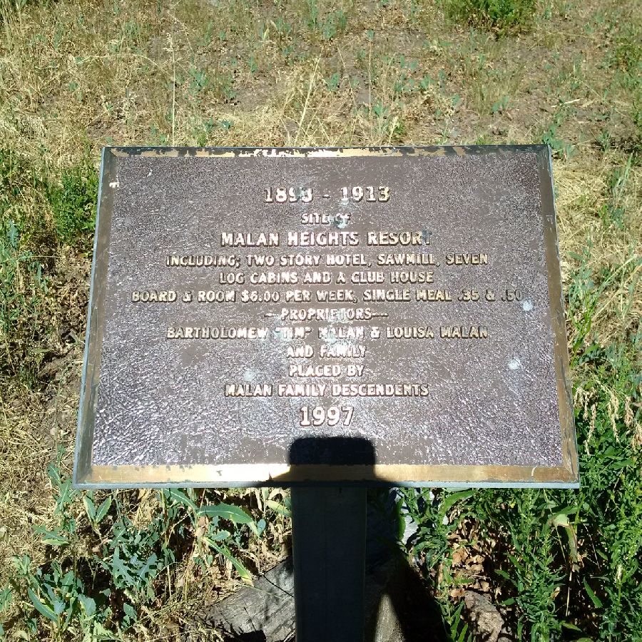
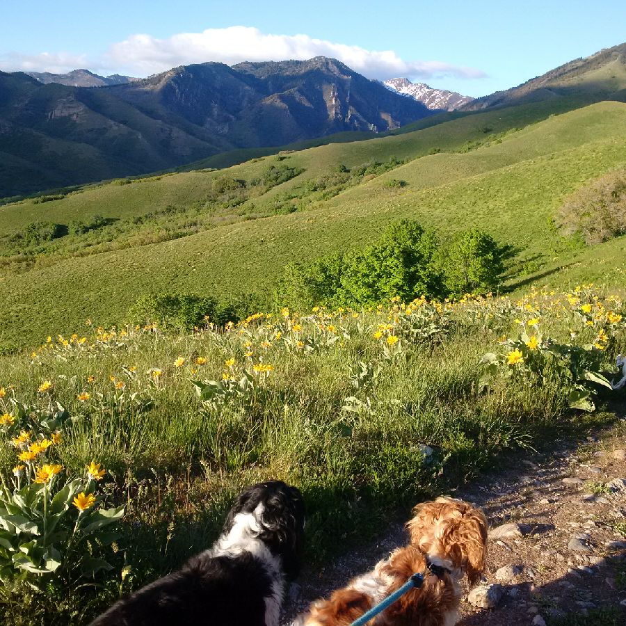
n my view the most stunning portion of the hike to Malan’s Basin, is stopping at the summit of Malan’s Peak. The peak provides majestic and panoramic views and is the true reward for making the 2000 ft elevation uphill charge. However, for those interested in the history I would also suggest Malan’s Basin which is a short 20 minute downhill hike from Malan’s Peak. You will know you are there because of the bronze placard commemorating the location.
Photograph Taken by Avid Amiri
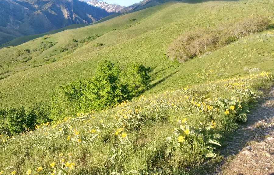
The basic also boasts a small stream for fresh water for any pets. This water would need to be filtered before it is fit for human consumption. The basin is also a favorite spot for campers and evidence of camp fire pits abounds. From the basin you no longer have any views of the city but can look up to the one towering peak of Mount Ogden up above.
This is easy to identify because of telecommunication equipment and an antenna tower. While it is possible to make the final leg of the hike to Mount Ogden, I have never identified the trailhead. On one occasion I ran into another hiker that conveyed they located the trail but it was heavily overgrown. He claimed that transgressing the trail would require a machete to cut back the foliage.
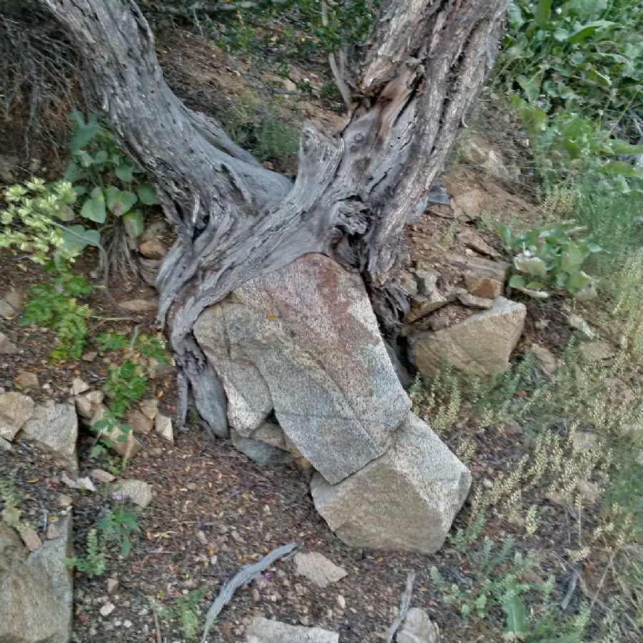
I am not sure about this but do know that if one has made the ascent to Malan’s Peak, dropping into Malan’s Basin below is a good idea. There are also some interesting tree and root formations. The shade on the Peak is non-existent as you basically stand atop craggy rock but as you make the descent to the Basin you will enjoy additional tree cover.
Note, at this elevation it is not unusual to be almost level with hawks and even eagles and you can spot them as they circle directly overhead.
If you have not yet been to Moab, Utah, I would strongly urge you to put it on the top of your list for a visit. There is a great deal to see and do in Moab, Utah, including the biking, hiking, climbing, rafting and off road adventure.
First, I would strongly caution against visiting in the summer months given the extreme heat. The best time of the year to make the trip is in the Spring or Fall. Given the profusion of activities I would suggest allocating at least a few days for your trip. However, if you are making it a short visit the activity I would recommend that one put on the top of their list is a side by side tour. These may be rented from the various outfits in Moab and will run a few hundred dollars for the day and these tours are self-guided. Most trails are very well marked so a self-guided tour should not pose an issue and most outfits will both recommend trails as well as drop the side by side off for you directly at the trailhead. While I am not generally much for motorized sport, I do think that the 4 wheel drive Razr’s can be a great way to cover substantial ground and therefore see more of the amazing landscape.
There is also technical skill involved in navigating up and through the various rock formations. One of my favorites is Poison Spider which will provide a good mix of challenging climbs as well as breathtaking scenery.
This trail will require the better portion of the day and will get you some elevation as you make the snakelike climb to the top of the plateau. Keep an eye out for white stripes painted on the rock that will guide you along the trail. I would also suggest bringing plenty of water and snacks and a can of tire repair or Fix-It-Flat in the event that you catch a sharp rock and have a puncture.
One of my absolute favorite hikes just minutes from downtown Salt Lake City, Utah is Black Mountain. Despite it ominous name, the hike is a uniquely memorable hike given the panoramic nature of the views from the summit.
The trail is well suited one for those willing to gain some altitude and engage in a more strenuous day hike. I would not recommend this hike for younger kids but for experienced hikers who are looking for a half day hike with significant elevation.
There are spots of this hike that are a virtual climb and even some short sections where there may be some light scrambling. While there is virtually no shade along the way and no additional sources of water other than what you have with you, I would recommend this hike in the spring or fall.
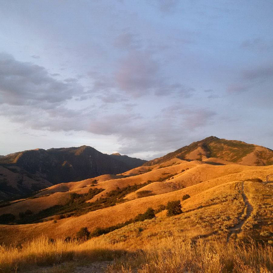
Photograph Taken by Avid Amiri
However, if you are visiting Salt Lake and have the time I strongly suggest it. The views from the summit and along the trail are truly breathtaking. If you are a resident of Salt Lake than this hike is perfect for a Saturday or Sunday afternoon. I would advise allocating at least 5 or 6 hours for this hike depending on your pace. Also packing wisely for this hike is a must. This includes bringing at least 40 ounces of water per hiker as well as sun screen and snacks or sandwich.
Personally, I would suggest that one pack at least 60 ounces of water so that you won’t have to ration water along the way and so that you can stay adequately hydrated.
The summit of Black Mountain is an ideal spot to take a break and enjoy a meal prior to making the descent back down to the base. My preferred starting point for the hike is North Bonneville Drive where one can easily park. This is a dead end street and there is a gate that leads to designated Forest Reserve land. There is a short 2 minute hike that winds to a small stream.
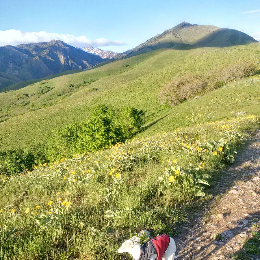
Photograph Taken by Avid Amiri
In recent years, the stream has been dry but the dry stream bed is easy to identify and if you take a right at the fork immediately past the stream bed this will provide you with a direct uphill climb that will take you past the Bonneville Shoreline Trail and to the Avenues Twin Peaks.
The nice thing about this access trail is that is very rarely utilized by casual hikers therefore allows one to have the trail largely to themselves. While other trails in this general area are heavily utilized by mountain bikers this one does not lend itself to bikes given the steep grade. Nearby is the well-recognized Bobsled Trail which is a favorite among locals.
The first phase of this hike is a series of uphill climbs and plateaus that step climb toward the Avenues Twin Peaks. There is moderate foliage largely scrub oaks and in the spring the area is replete with wildflowers and grasses. This portion of the hike is exactly one mile. When you reach the first peak you will see City Creek down below on the north slope. You will take the right and head toward Black Mountain whose telltale black peak serves as an identifiable beacon so that one can gauge distance and remaining mileage.
When one reaches the Avenues Twin Peaks there will be another fork. You will take the left side of the fork and the single trail will lead you to the summit. Therefore, these is little risk of getting lost or off track along the way.
The second phase of the hike shall be several miles and will follow a ridgeline to the base of Black Mountain. This third phase of the hike is the challenging segment of the hike with a very steep pitch to the trail and quite a bit of loose rock and shale.
Be prepared for some measure of scrambling in some spots. This last portion of the hike will be about another mile and the scrub oak will turn to evergreen.
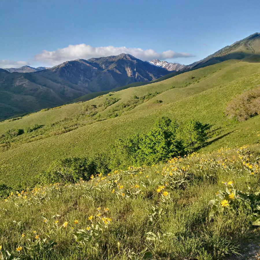
Photograph Taken by Avid Amiri
Note, if you have dogs with you and you allow them off leash, this hike has quite a bit of prickly pear that can be difficult to spot. On more than one occasion I have had to extract these from the paws of my pets. The summit of the Black Mountain is well worth all the effort with stunning panoramic views that allow one to see although way to Mount Bonneville in Ogden, Utah and you have a clear view of Mount Olympus and even view to Park City.
This is one Salt Lake City hike you will not want to miss!
Wheeler Canyon, Utah is great spot within short distance of Ogden. This is the location of the Wheeler Canyon Trail. In order to reach Wheeler Canyon one must make the drive up 12th Street to where it converts to Ogden Canyon road. There is about a 20 minute drive up the canyon. The hike begins at the periphery of the damn on the west side of Pineview Reservoir. It is a popular hike with a reasonable amount of traffic both from mountain bikers and hikers.
Despite the initial traffic, this does thin out somewhat as you make you way your way u the hike. The hike starts out as more of a dirt road than trail that runs up a canyon and has a river running along the side. There is moderate shade on either side but in most segments the road is exposed to the sun. Therefore, I would not recommend this hike necessarily in the extreme heat of summer.
This is also a great early morning or late afternoon hike. The preliminary segment of this hike is reasonably straight and runs for about a mile and a half where it breaks off into a separate trail for Icebox Canyon. This is the more scenic stretch of the trail and it is heavily shaded.
While the dirt road for Wheeler Canyon continues on, the Icebox Canyon Trail, drops off from the road. You will have no trouble finding the access to Icebox Canyon trail as it is marked with signage and after a short switchback will lead you across a wooden bridge.
I highly recommend discovering and enjoying this hike. The stream that runs along its edge is great watering source for any pets. It is also very quiet save the sound of the running water and the songs of the birds. The temperature is always cool in Icebox Canyon and it is a gentle grade.
This is always a scenic and relaxing hike. I recommend this hike for hikers of all ages.
This hike is also especially memorable in the fall with the rich abundance of fall colors with all the Aspen and Cottonwood trees.
There are a series of scenic short hike along the Ogden Trail Network in Ogden, Utah for the less experienced hiker. These are all easily accessible from downtown Ogden. There is always plenty of free parking at the trailheads and most trails are lightly populated. In particular, one can choose various spot to jump on the Bonneville Shoreline Trail.
This segment of the trail runs north to south and is typically a very easy segment of the trail network. In the spring they are also a great spot to go birdwatching and the area has been a frequented destination for bird enthusiasts. However, my suggestion is to explore the trails that run east into the various canyons such as Taylors Canyon and Waterfall Canyon.
One of my favorites is the Indian trail which runs along the canyon slope well above Ogden Canyon Road. There is also the waterfall hike which leads to an impressive 100 ft waterfall which cold mountain snow melt that cascades off of the granite spire at the top of the hike. You will be pleasantly surprised by the size of the waterfall and the incredible views.
In the last couple of years, they have also built a zip line that runs above the waterfall. While the zipline is a short one, I have been told it is a fun time for kids and adults alike. As mentioned elsewhere in my blog, be on the lookout for wildlife including deer, porcupine, skunk, and rattlesnake. These creatures are all non-aggressive and will generally turn tail at the sign of humans.
Even the rattlesnakes have no interest in humans but have been known to lunge at dogs if they feel threatened. Please be respectful of all wildlife and be sure to clean up after yourselves. There are miles of fantastic trails ready for discovery for those willing to get outside and explore them.