Malan’s Peak: Ogden, Utah
The most avid mountaineer or hiker would appreciate the miles of first class hiking and mountain biking terrain afforded by the Ogden Trails Network. This network is composed of over 35 miles of extremely well maintained hiking and mountain biking trails. The incredible trails are generally lightly populated and very easily accessible from various trailheads just a few minutes from downtown Ogden. They offer cool shade in the summer and one of a kind breath taking views as one gains in elevation.

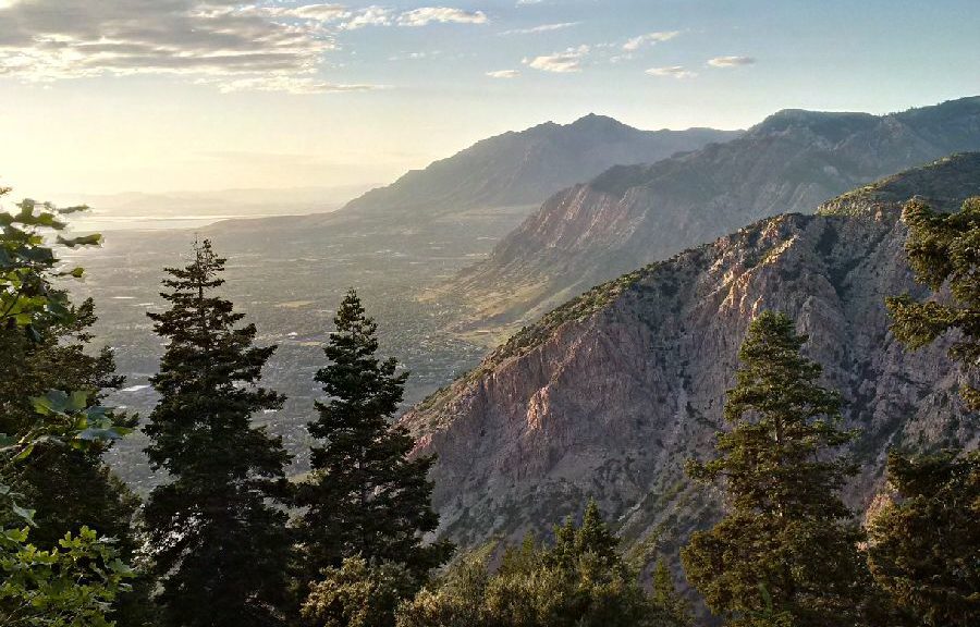
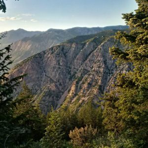
The accessibility of this network is really quite remarkable. The trail network is accessible through a series of well marked trailheads that run north to south along the eastern periphery of the city. In particular, one of my favorites it Malan’s Peak which is a phenomenal hike that provides a good uphill exercise and plenty of vistas and viewing locations to survey expansive views of the city and the western reaches beyond. There is no shortage of awe inspiring viewing locations and the hike is a reasonable one for hikers of all skill levels. The hike is also easy to find as the trail is well marked with trailhead markers and signage and is well visible despite moderate growth along the sides of the trail in some areas.
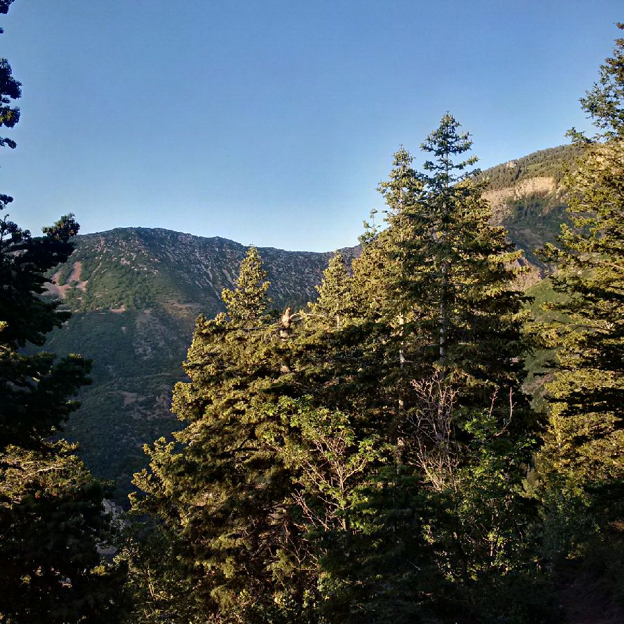
The first time I did Malan’s peak I was not quite prepared for the length of the uphill climb. While was a fairly easy grade in most places it does feel interminable during the last couple of miles of the uphill. The length of the hike depending on your starting location can be around 8-10 miles. I would classify the hike as a morning or afternoon hike and would encourage one to bring snacks and to bring plenty of water (at least 60 ounces) and to don sturdy hiking shoes. For those not prepared for this length of a hike, there are no shortage of stopping points and one can cut the hike short, take in the views and backtrack. The hike begins in a deciduous environment, mostly scrub oaks and shrubs. As one continues the climb and ascends to higher elevations the environment turns coniferous, with towering evergreen trees and the fragrant scent of pine. One will follow the trail that continues on to Taylors Canyon and turn right at the well-marked sign that crosses a short 8 foot wooden bridge.
What is especially nice about the hike up until this point is that you are accompanied by a stream that lightly cools the shaded trail and provides the soothing sounds of running water. This stream is fed by a cave spring up above. You will at one-point traverse almost directly on top of it and this is a great stopping point for views. In particular, this is a spot where one can drop in below the trail to refill water bottles. The water is renowned for its purity and gushes from the cave spring all year long (although I hear does sometime freeze in the coldest times of the winter). I have consumed water from the spring many times and have found it always to be very refreshing and have never had an issue with stomach upset. Moreover, given the purity (I am assuming the waters source is the snow melt from Ogden Canyon up above) I have never once had to filter the water or purify it in any way. Given the high mineral content, it is always very flavorful. As an aside, I have come across individuals with handcarts and large water containers that make the hike to this point simply to “harvest” the water. When speaking to some of these individuals they claim that the water has certain unique properties that make it a desirable spring water. While I cannot comment on that, I do appreciate the stopping point on the way up (as well as again on the way down) to fill up on water for the miles ahead.
In terms of the history of Malan’s Peak as well as Malan’s Basin beyond, this used to be the location of a hotel in the early 1900’s. Apparently, the hotel burned down but one can still see evidence of the structure including the old boiler where the hotel once stood.
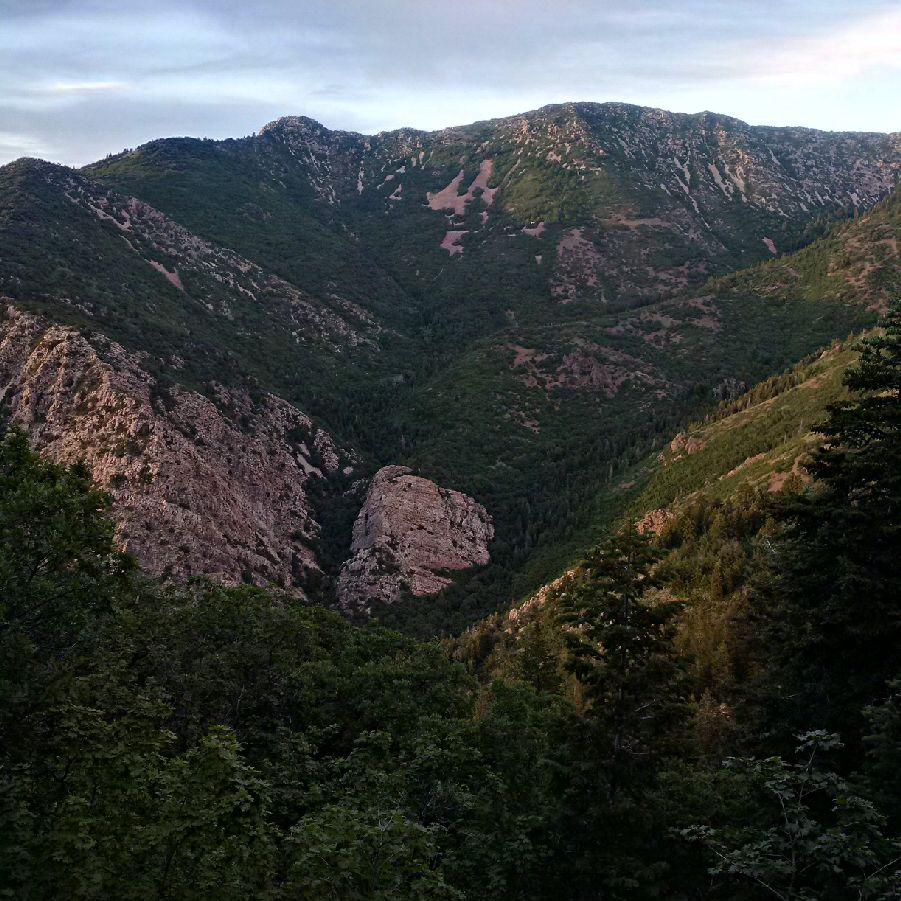
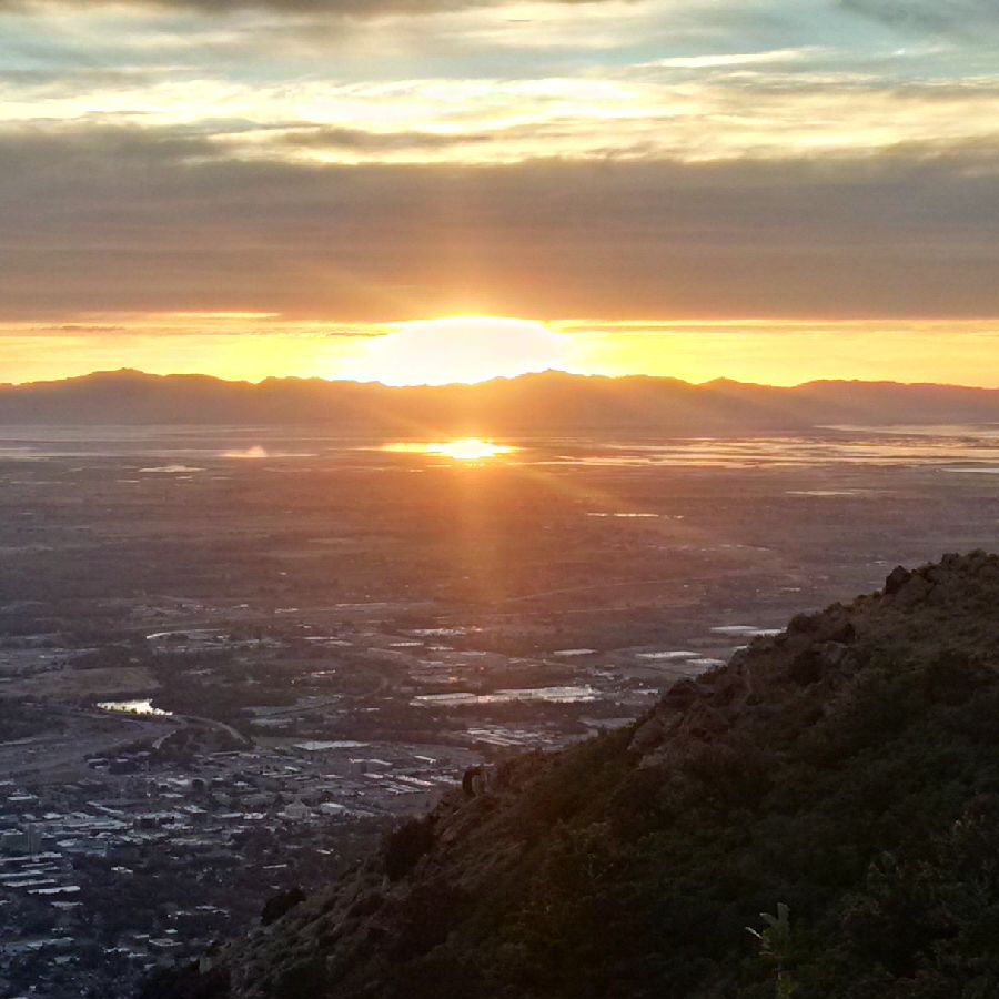
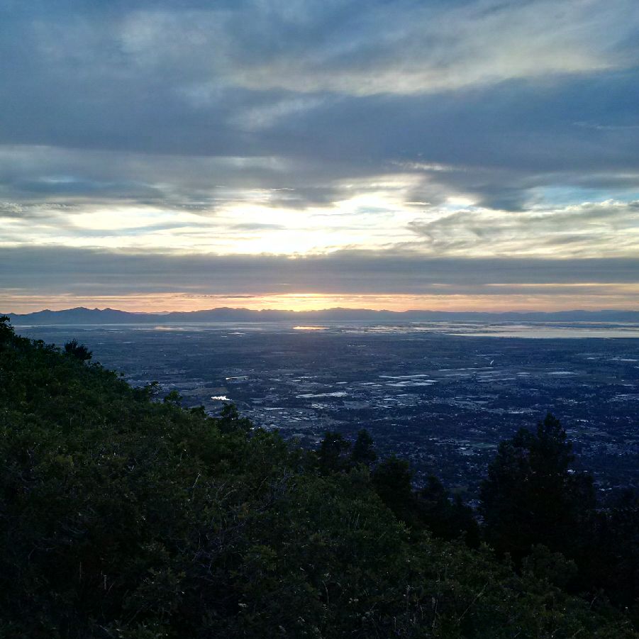
I would suggest that hikers make their way to the summit as this is truly a phenomenal hike and the views from the peak are panoramic. Depending on when you begin your hike be prepared for a stunning sunset to the west over Antelope Island and the Great Salt Lake. The hike is dog friendly, has great visibility, and is generally always lightly populated. Spring and Fall are the best times to conduct this hike but I have made the summit in the hottest parts of the June or July and have still enjoyed it. I would recommend bringing a flash light if you begin the hike in the afternoon and also pack bug spray as there are mosquitos at the higher elevation although they are not overwhelming. One other caveat is to keep an eye of for rattlesnakes. While they are not aggressive and will not go out of their way to strike, you are in their natural habitat, therefore, a curious off leash dog could be a target for a rattler in a defensive posture. Please note, it is unlawful to harm the snakes. I would ask that you keep your dog on leash and just keep an eye out for the snakes. You will see them with regularity and I generally spot rattlesnakes about once every other time I perform this hike – so the odds you will see one is about 50-50. Having said that, they are not aggressive and provide ample warning if they feel they are threatened.
I have includes some images from my last visit summer of 2016. This is truly a great day hike in Utah and a hike that will leave you with a sense of accomplishment having made good use of your morning or afternoon.